Precision Agriculture 2026: 7 Smart Farming Wins
Precision agriculture is no longer a future concept. By 2026, it is becoming the practical operating system for modern farming, forestry, and wider land management. The big shift began in 2025, when more growers and land managers started using data, sensors, remote sensing, drones, automation, and AI to optimize decisions within fields and across large landscapes. What matters now is not just technology for its own sake, but how these tools help manage soil, irrigation, nutrient inputs, pest control, and climate risk with better precision.
That matters because agriculture is being asked to do more with less. Producers need stronger yields, tighter costs, lower water use, reduced runoff, fewer unnecessary fertilizer and pesticide applications, and more resilience to drought, heat, and market volatility. At the same time, sustainability is moving from a nice-to-have goal to a core business metric across crops, orchards, agroforestry systems, plantation forestry, and even reclamation projects on disturbed land.
The result is an evolving, digital, increasingly integrated approach to managing variability. Instead of treating every acre the same, precision systems help users monitor what is happening within fields, identify stress early, and targeted responses where they will have the highest impact. In this blog, we will break down the seven biggest smart farming wins shaping precision agriculture in 2026 and beyond, explain the key technologies behind them, and show how the same logic is extending into horticulture, agroforestry, silviculture, and responsible site stewardship for mining-impacted land.
Table of Contents
Key Insight: Precision agriculture creates value when it connects monitoring, decision support, and action. Data alone does not improve a farm. Better timing, better zoning, and better field-level execution do.
Why Precision Agriculture Matters Even More in 2026
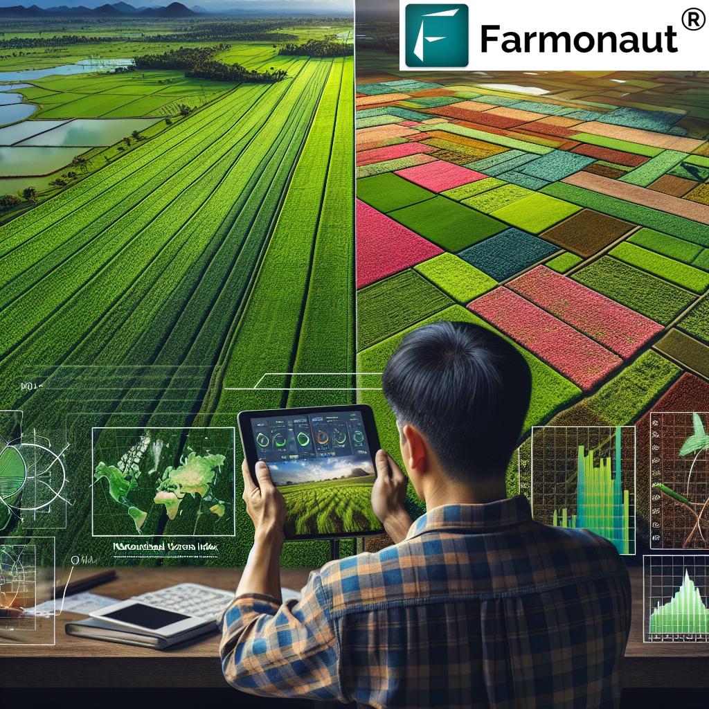
In 2025, the sector was already increasingly defined by the use of digital tools to manage variability in crops and landscapes. By 2026, that shift is becoming deeper and broader. The reason is simple: uncertainty is higher. Weather swings are sharper, labor is tighter, water is more contested, and margin pressure is stronger. A field may have major differences in soil moisture, organic matter, temperature, pH, and disease pressure from one zone to another. Treating it as uniform wastes money and can damage long-term soil health.
Precision agriculture uses data from satellites, UAV surveys, weather feeds, soil probes, machines, scouting logs, and cloud dashboards to reveal that hidden variability. Once that variability is visible, managers can act with more confidence. They can alter irrigation scheduling, change nutrient timing, vary lime use per zone, prioritize disease scouting, or adjust the route of field equipment to reduce compaction. These are not abstract ideas; they are operational upgrades that directly affect profitability and environmental performance.
In many regions, the strongest business case starts with three areas: soil health, irrigation accuracy, and pest management optimization. These affect both yield and cost in obvious ways. But the value of precision tools also extends to harvest timing, replant planning, orchard quality management, wildfire risk reduction in forestry, and compliance tracking for reclamation sites. That is why the role of digital farming is expanding across related industries, not just row-crop agriculture.


These app links offer access to Farmonaut’s satellite-based tools through web, Android, and iOS interfaces.

The 7 Precision Agriculture Smart Farming Wins for 2026
1. Better soil intelligence leads to smarter input management
The first major win is improved understanding of soil variability. With in-field sensors, lab analysis, and remote imagery, managers can monitor moisture, temperature, pH, texture patterns, salinity, and organic matter. That matters because nutrient performance is rarely uniform across a field. A fertilizer plan that works in one zone may underperform or increase runoff in another.
When soil sensing is paired with variable-rate application, applicators can adjust water, fertilizer, and lime per zone. This improves nutrient use efficiency, reduces waste, and helps lower emissions associated with excess input use. In practical terms, better soil intelligence often means fewer blanket applications and more targeted interventions based on what the crop actually needs at each stage.
- ✔ Key benefit: More precise nutrient placement can improve root-zone efficiency and reduce unnecessary fertilizer use.
- 📊 Data insight: Soil maps help reveal hidden variability that yield maps alone may miss.
- ⚠ Risk or limitation: Cheap sensors with poor calibration can create misleading recommendations.
- 🌱 Sustainability angle: Better matching of inputs to need supports healthier soil function over time.
- 💰 Profit angle: Reduced overapplication can lower seasonal costs without sacrificing crop quality.
Pro Tip: Start with one field or management block and compare stable zones versus variable zones. Precision agriculture works best when baseline maps and in-season observations are combined rather than used in isolation.
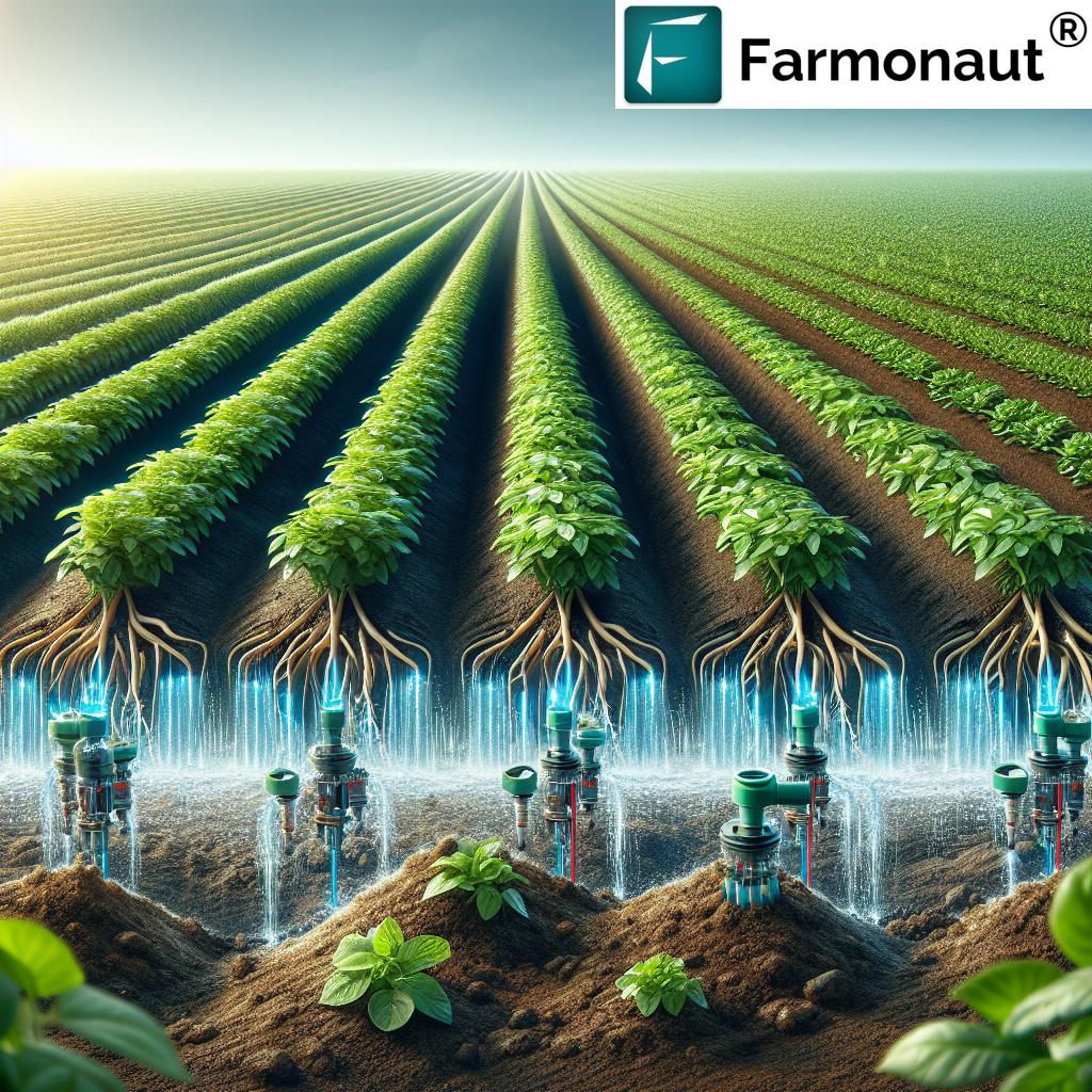
2. Precision irrigation protects water, yield, and resilience
Precision irrigation is one of the clearest wins in 2026. Water scarcity, rising pumping costs, and climate instability make irrigation management a top priority. Satellite imagery, thermal maps, soil moisture probes, and weather integration can guide when and where to irrigate. Instead of relying only on fixed schedules, managers can respond to actual field conditions.
This matters especially in water-stressed regions, but it is equally valuable where overwatering causes root disease, nutrient leaching, or poor fruit quality. Precision irrigation helps growers reduce water use while maintaining plant performance. It also improves the timing of irrigation around heat stress events, flowering, or grain fill, which can stabilize yields in difficult seasons.
By 2026, the strongest irrigation systems are increasingly integrated with dashboards that combine field data, weather forecasts, and crop stage models. These platforms guide daily decisions and help plan adaptive responses during drought, extreme heat, or changing water allocations.

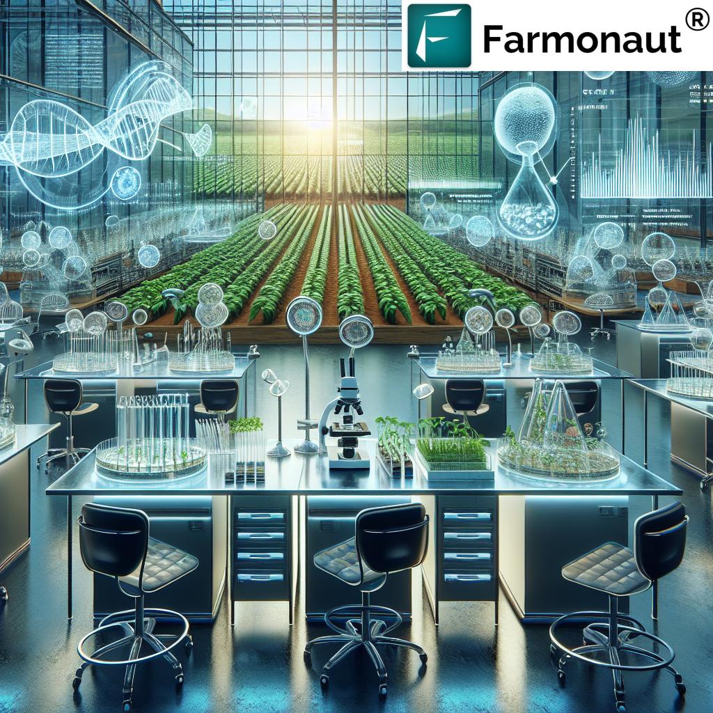
3. AI pest and disease detection reduces losses before they spread
Pest and disease outbreaks are expensive not only because of direct crop damage, but also because delayed detection can trigger broader control costs later. In 2026, AI-based scouting systems, drone imagery, remote sensing, and smart traps are making pest management more proactive. The advantage is speed. Subtle canopy changes, thermal anomalies, or patterns of feeding damage can be flagged before visible injury becomes severe.
This is a major shift from calendar-based spraying toward integrated and evidence-based control. Instead of applying pesticide uniformly as insurance, managers can use real-time pressure maps and outbreak forecasts to guide targeted applications. That helps reduce chemical load, lower costs, and minimize resistance pressure.
For specialty crops, where quality premiums are high, early disease alerts can protect both marketability and shelf life. In broadacre systems, they can prevent spread across large areas. In forestry, these same methods support early detection of invasive species, canopy stress, or localized pest pressure in plantation blocks and natural stands.
4. Variable-rate application cuts waste and improves return on inputs
Variable-rate technology remains one of the most practical expressions of precision agriculture. Once field variability is mapped, applicators can alter seed, nutrient, water, or crop protection rates in real time. This supports a move away from “average-rate” thinking, which often fails both high-potential and low-potential zones.
The return comes from matching input intensity to expected response. Strong zones may justify different nutrient timing than weaker zones. Saline areas may need a different management approach than well-drained ridges. Liming requirements can vary significantly across short distances. Variable-rate systems allow that complexity to be managed more efficiently.
As machine control software improves, these systems are becoming easier to implement without excessive customization. That is good news for adoption in 2026, because the best technology is the one a team can maintain and actually use across seasons.
Common Mistake: Buying advanced variable-rate equipment before building reliable field zones and decision rules. Hardware without sound agronomy can increase complexity without improving outcomes.
5. Automation and robotics improve labor efficiency and reduce compaction
Labor constraints are pushing more farms and land operations toward automation. Autonomous tractors, robotic weeders, robotic harvesters, and machine-guided implements can improve timeliness and reduce repetitive labor pressure. They can also reduce overlap, improve route planning, and in some cases lower fuel use.
Another overlooked benefit is reduced compaction. Smaller robotic systems can perform tasks with less soil pressure than heavy conventional equipment. In horticulture, robotic tools can assist with pruning, thinning, selective spraying, and fruit handling. In forestry and agroforestry, robotic systems can support planting, stand checks, monitoring of seedlings and saplings, and selective intervention planning.
The smartest deployment model is not to automate everything. It is to automate the tasks where timing, repetition, and consistency matter most. That could be weeding, scouting, irrigation checks, or machine guidance in narrow time windows.
6. Yield forecasting and predictive analytics improve planning
The sixth win is better forecasting. Machine learning models can pull together weather records, vegetation indices, management history, and field observations to estimate likely outcomes before harvest. Yield forecasting supports logistics, storage planning, contract timing, labor scheduling, and market decisions.
These predictive tools also help quantify risk. If a crop is entering a heat-sensitive growth stage under poor moisture conditions, management can shift quickly. If disease pressure is expected to rise after a weather event, scouting and treatment plans can be adjusted. In forestry, growth models and stand monitoring can support thinning schedules, harvest timing, and long-term carbon planning.
The key point is that predictive analytics does not replace field judgment. It supports it. Good models narrow uncertainty; they do not eliminate it. In 2026 and beyond, the strongest decision systems will combine models, human expertise, and live field data.

7. Landscape-scale stewardship expands precision agriculture beyond the farm gate
The seventh win is broader than yield. Precision tools are now helping manage sustainability and stewardship across larger landscapes. In forestry, drones and satellite imagery can detect stress, support wildfire risk reduction, guide thinning, and monitor regeneration. In agroforestry systems, the same methods help track shade patterns, tree establishment, moisture distribution, and species performance.
On disturbed or mining-impacted land, precision methods support reclamation by tracking vegetation recovery, erosion control, and moisture conditions. That improves compliance visibility and helps managers identify weak areas before they become long-term failures. Even in minerals and gemstone operations, precision land monitoring can reduce disturbance and improve rehabilitation planning, supporting more responsible sourcing and environmental stewardship.
This is one reason precision agriculture should be seen as part of a larger precision land management movement. The same technologies that improve crop profitability can also strengthen resilience, biodiversity outcomes, and long-term resource stewardship.
Investor Note: The strongest long-term value often comes from systems that improve both productivity and environmental visibility. Tools that support emissions tracking, resource use monitoring, and land health metrics are likely to stay relevant well beyond one season.
Visual List 1: What precision agriculture optimizes
- 🛰️ Remote sensing for crop vigor, biomass, and stress maps
- 💧 Irrigation timing based on moisture, weather, and heat risk
- 🧪 Nutrient management using soil data and crop stage
- 🐛 Pest and disease control using AI alerts and targeted scouting
- 🚜 Equipment efficiency through automation and better field routing
Visual List 2: What precision agriculture minimizes
- 📉 Input waste from blanket fertilizer and pesticide use
- 🌊 Runoff and leaching tied to overapplication or poor timing
- 🧱 Compaction from unnecessary machine passes
- 🔥 Climate risk exposure through slow response to drought and heat
- ⏱️ Decision delays caused by fragmented field information

Smart Farming Technologies and Estimated Impact in Precision Agriculture
One of the easiest ways to evaluate digital farming tools is to compare them by function, data source, cost level, and expected operational impact. The table below is designed for quick decision support. These are estimated ranges, not exact guarantees, because actual outcomes depend on crop type, baseline management, climate, equipment quality, and agronomic execution.
| Technology | Primary Use | Data Source | Estimated Cost Level | Estimated Yield Gain | Estimated Water Savings | Estimated Input Reduction | Best Fit Crops/Forestry Use |
|---|---|---|---|---|---|---|---|
| Satellite monitoring | Track crop health, biomass, moisture stress, and broad field variability | Multispectral satellite imagery, weather integration | Low to Medium | 5–12% | 8–20% | 5–15% fertilizer/pesticide reduction | Row crops, plantations, rangeland, forestry block monitoring |
| IoT soil sensors | Measure soil moisture, temperature, pH, and root-zone conditions | In-field probes, telemetry, dashboards | Medium | 4–10% | 10–30% | 6–18% nutrient and irrigation reduction | Vegetables, orchards, vineyards, greenhouse, high-value crops |
| AI pest detection | Early warning for pest pressure and disease outbreaks | Images, traps, field scouting logs, machine learning models | Medium | 3–9% | 0–8% | 8–20% pesticide reduction | Fruit, vegetables, cereals, plantations, forestry health monitoring |
| Variable-rate application | Adjust seed, fertilizer, lime, or crop protection per zone | Soil maps, yield maps, prescriptions, machine controllers | Medium to High | 5–15% | 5–15% | 10–25% fertilizer and lime reduction | Row crops, oilseeds, grains, sugar crops, silviculture nutrition programs |
| Precision irrigation | Deliver water based on actual demand and weather risk | Soil moisture sensors, thermal imagery, weather, ET models | Medium to High | 6–15% | 15–35% | 5–12% energy and nutrient reduction | Orchards, vegetables, cotton, vineyards, nurseries, reclamation sites |
| Drone scouting | High-resolution scouting for stress, weeds, disease, and stand gaps | UAV multispectral and thermal imagery | Medium | 4–11% | 5–12% | 6–18% targeted spray/input reduction | High-value crops, seed production, forestry surveys, post-disturbance monitoring |
| Yield forecasting | Plan harvest, logistics, market timing, and risk mitigation | Historical records, weather, vegetation indices, AI analytics | Low to Medium | 2–8% | 0–10% | 3–10% operational input reduction | Broadacre crops, plantations, storage planning, timber harvest scheduling |
This comparison shows why no single tool solves every problem. Precision agriculture works best as a layered system. Satellite monitoring gives wide-area visibility. Soil sensors deepen field understanding. AI pest detection adds protection. Variable-rate tools convert prescriptions into action. Precision irrigation saves water. Drone scouting validates anomalies. Yield forecasting supports planning. Together, they create a stronger operational loop from observation to action to verification.
Applications of Precision Agriculture Across Agriculture, Forestry, and Reclamation
Agriculture and field crops
In conventional cropping systems, the most valuable applications often involve nutrient management, stand monitoring, irrigation, and in-season stress detection. Satellite and drone imagery can reveal uneven emergence, nutrient deficiencies, biomass gaps, or disease patterns. Soil and weather integration can guide in-season nitrogen decisions, irrigation triggers, and harvest timing. The result is a system that helps optimize input use while protecting yield potential.
Horticulture and specialty crops
Specialty crops demand higher levels of precision because the market rewards quality, consistency, and timing. Microclimate control, shading decisions, moisture management, and selective intervention are all important. Sensor-driven irrigation and thermal mapping can help preserve fruit quality during heat events. Drone imagery can identify weak rows or irrigation block issues quickly. Robotic systems may also support pruning, thinning, and quality-focused crop management.
Forestry and agroforestry
In forestry, precision tools are increasingly useful for stand health monitoring, regeneration tracking, invasive species detection, and wildfire risk planning. Drones and satellite imagery can monitor canopy stress, identify underperforming zones, and guide thinning decisions. In agroforestry, where trees and crops interact within the same system, precision mapping helps understand shade effects, moisture competition, and species performance over time. These are critical capabilities as land managers seek stronger carbon outcomes, biodiversity support, and productive mixed-use landscapes.

Mining-impacted land and reclamation
Precision land management also matters after extraction. Reclamation success depends on soil stabilization, moisture management, revegetation progress, and erosion control. Remote sensing allows managers to track vegetation cover, moisture stress, and weak establishment zones over time. This supports faster intervention and better reporting. While this application is adjacent to farming, it draws on the same digital logic: observe conditions continuously, identify problem areas early, and respond precisely rather than broadly.
Responsible land stewardship in resource operations
In minerals and gemstone operations, precision mapping and monitoring can help minimize disturbance footprints and improve environmental stewardship. Disturbed areas can be tracked, recovery can be documented, and emissions or resource use can be monitored more systematically. This strengthens accountability and supports practical sustainability actions on the ground.
Field Reality: The same precision tools can serve very different sectors. A multispectral map may guide fertilizer timing in crops, detect invasive species in forestry, or track vegetation recovery on a reclamation site. The core value lies in timely visibility and targeted action.
Implementation Considerations for Precision Agriculture in 2026 and Beyond
Adoption does not need to begin with a fully automated, sensor-heavy operation. In fact, the most effective approach is often staged. Organizations that start with one or two high-impact pilots tend to learn faster and avoid unnecessary complexity. For many operations, the best first step is irrigation optimization or early disease detection because the return can be visible within a season.
- Start small, measure clearly: Choose one field, one orchard block, or one forestry compartment. Track costs, yield response, water savings, and operational changes.
- Invest in durable equipment: Field-ready and solar-powered or long-life sensors reduce maintenance burden, especially in remote areas.
- Use platforms with practical support: A dashboard is only useful if teams can interpret it and act on it quickly.
- Plan data pipelines early: As imagery, sensor logs, and machine files grow, cloud storage, cybersecurity, and interoperability become more important.
- Build workforce skills: Teams need data literacy, calibration discipline, and confidence using recommendations alongside agronomic judgment.
There are also governance questions. Farmers and land managers should understand who owns the data, who can access it, and how it can be shared. Interoperability standards matter because disconnected systems create friction. A farm may use one platform for irrigation, another for equipment, another for weather, and another for scouting. The 2026 opportunity is to reduce those silos and create cleaner decision pathways.
Climate adaptation should also be part of every implementation plan. A precision system should not only optimize a normal year. It should support mitigation and adaptive responses during bad years. That means forecasting drought risk, heat exposure, disease windows, and likely stress zones before losses escalate. Tools that support this kind of resilience are likely to offer the best long-term return.
Strategy Tip: Precision agriculture adoption should follow a simple order: monitor, interpret, act, and review. Skipping the review step makes it hard to refine prescriptions and improve next season’s decisions.
Where Farmonaut Fits in the Digital Precision Agriculture Stack
Farmonaut is a satellite technology company focused on making satellite-driven insights more affordable and accessible across agriculture, mining, infrastructure, defence strategies, and intelligence through Android, iOS, web/browser access, and API delivery. In practical terms, this means we provide satellite-based monitoring, AI-supported advisory tools, blockchain-enabled traceability, and resource management capabilities that can support more informed decisions in data-driven operations.
For agriculture and related land-use sectors, we use multispectral satellite images to help monitor vegetation health, crop conditions, and wider land patterns. This supports visibility into field performance without requiring every user to deploy costly hardware everywhere. We also provide an AI-based advisory system called Jeevn AI, which delivers insights and weather-based guidance that can support operational efficiency and planning.
For organizations that need system integration, our satellite and weather interfaces are available through the Farmonaut API, while technical setup details are available in the API developer documentation. This can be useful for businesses that want to bring satellite monitoring or weather-linked analytics into existing dashboards, workflows, or enterprise systems.
Beyond monitoring, Farmonaut also offers additional product pathways that fit specific operational needs. For example, large-scale farm management tools can help enterprises oversee complex field operations more efficiently. Traceability solutions are relevant where supply chain transparency matters, especially for agriculture and resource-linked products. Carbon footprinting tools can support users who want more visibility into emissions and sustainability reporting. For operators managing vehicle logistics and machinery movement, fleet management tools can help optimize usage and reduce operational friction.
In financing-linked contexts, crop loan and insurance support tools can be relevant because satellite-based verification can strengthen process efficiency and reduce verification gaps. For users working in crops, plantations, or forest-linked landscapes, crop, plantation, and forest advisory access provides a practical route to explore digital monitoring and AI support across different land-use settings.
What is important here is clarity about scope. Farmonaut is not an online marketplace, not a manufacturer or seller of farm inputs or machinery, and not a regulatory body. Instead, we focus on affordable satellite technology, AI-based advisory support, blockchain-based traceability, and resource management tools that can help users act with better information.

Explore Farmonaut Tools
If a digital farming strategy needs scalable satellite-based visibility, mobile access, and API-ready workflows, the links below offer direct ways to explore the platform.
Why the Next Phase of Precision Agriculture Will Be About Integration
The next stage of digital farming will not be won by isolated tools. It will be won by systems that connect imagery, field sensors, machine records, weather forecasts, and operational workflows. A thermal drone map is useful, but it becomes much more valuable when linked with irrigation controls. A pest alert is useful, but it becomes more actionable when combined with scouting routes and treatment records. A yield forecast is useful, but it gains more business value when linked with market demand, storage capacity, and harvest logistics.
That is why 2026 is such an important year. It marks a broader move from testing technology to operationalizing it. The sector is increasingly asking not “Can this tool collect data?” but “Can this tool help manage risk, reduce waste, and improve decisions at speed?” In that sense, the best precision agriculture platforms are not just data repositories. They are decision environments.
The same trend is visible across forestry and reclamation. Monitoring alone is not enough. The value comes when insights guide planting density, thinning schedules, erosion control, revegetation timing, or environmental reporting. As climate pressure grows, those integrated workflows will become more important than ever.
Conclusion: The Real Win in Precision Agriculture Is Better Decisions
Precision agriculture in 2026 is about much more than gadgets. It is an evolving management approach that uses data, sensors, remote sensing, automation, and AI to optimize what happens within fields and across larger land systems. It improves visibility into soil conditions, irrigation needs, nutrient variability, pest pressure, disease risk, and yield potential. It helps reduce waste, conserve water, lower runoff, improve efficiency, and strengthen resilience under climate stress.
The seven smart farming wins are clear: stronger soil intelligence, better irrigation accuracy, earlier pest and disease detection, more efficient variable-rate application, practical automation, smarter forecasting, and broader landscape stewardship. Together, these wins support productivity and sustainability at the same time.
For agriculture, horticulture, forestry, agroforestry, and reclamation, the direction is the same. Better information leads to better timing. Better timing leads to better resource use. Better resource use supports profitability, resilience, and environmental performance. That is why precision agriculture is not a short-term trend. It is increasingly the framework through which modern land management will be defined in 2026 and beyond.
FAQ: Precision Agriculture in 2026
1. What is precision agriculture in simple terms?
Precision agriculture is a management approach that uses data, sensors, satellite imagery, drones, software, and automation to manage variability within fields. The goal is to apply the right input, at the right place, at the right time to improve yields, reduce waste, and strengthen sustainability.
2. Why is precision agriculture becoming more important after 2025?
After 2025, farms and land managers face stronger pressure from climate shocks, water scarcity, labor shortages, rising input costs, and sustainability requirements. Precision agriculture helps address these pressures by improving visibility, timing, and targeted decision-making.
3. Which technologies deliver the fastest return?
For many operations, the fastest return often comes from irrigation optimization, satellite crop monitoring, AI-supported pest detection, and variable-rate input application. The best starting point depends on whether water, disease, nutrient efficiency, or labor timing is the largest current constraint.
4. Can precision agriculture help forestry and agroforestry too?
Yes. In forestry and agroforestry, precision methods help monitor stand health, detect invasive species, guide thinning, track seedling and sapling establishment, and support moisture and canopy management. These tools also support wildfire risk reduction and long-term land stewardship.
5. Does precision agriculture always require expensive hardware?
No. Some systems rely heavily on hardware, but satellite-based monitoring and cloud platforms can lower the barrier to entry. Many operators begin with software and remote sensing, then add field sensors or variable-rate equipment later as their needs grow.
6. What are the main risks when adopting precision agriculture?
Common risks include poor sensor calibration, weak data governance, disconnected software tools, overcomplicated setups, and lack of staff training. Starting with focused pilots and clear success metrics helps reduce these risks.
7. How does Farmonaut relate to precision agriculture?
Farmonaut is a satellite technology company that provides satellite-based monitoring, AI-based advisory support, blockchain-based traceability, and resource management tools across agriculture and other sectors. Through web, mobile apps, and APIs, we help make satellite-driven insights more accessible for data-informed decision-making.
8. Is precision agriculture only for large farms?
No. Large enterprises may adopt more layers of technology, but smaller farms can also benefit from satellite monitoring, weather-linked advisory support, and selected sensor deployments. The right scale is the one that matches the operation’s goals and budget.