Normalized Difference Vegetation Index NDVI: 7 Tips 2026
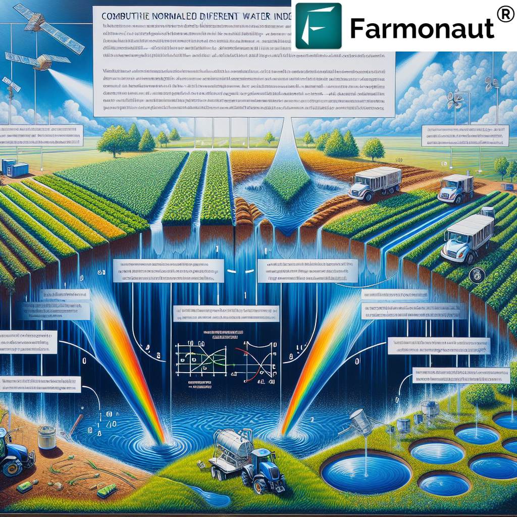
The normalized difference vegetation index NDVI is accelerating innovation and sustainability across agriculture, forestry, mining, and land management in 2026 – and for good reason. With unprecedented insights into vegetation health, growth patterns, and environmental dynamics, NDVI has become a critical, data-driven tool empowering decision-makers to act proactively.
What is NDVI? Demystifying the Normalized Difference Vegetation Index
The Normalized Difference Vegetation Index NDVI is a numerical indicator derived from satellite or drone-based remote sensing measurements. It quantifies vegetation density and vigor by comparing how much near-infrared (NIR) and red light is reflected or absorbed by living plants.
- 🌍 NDVI Formula:
(NIR - Red) / (NIR + Red) - 🌱 Values: NDVI values range from -1 to +1
- 🟢 Healthy, dense vegetation: Typically registers values close to +1
- 🟤 Barren or sparsely vegetated land: Yields results near zero or negative values
Plants strongly reflect NIR light but absorb red visible light through photosynthesis. By analyzing this difference, NDVI provides an accurate snapshot of vegetation health, density, and spatial changes across vast areas. This makes NDVI a critical tool for assessing crop health, forest cover, environmental change, and land management.

Why NDVI is Indispensable in 2026 and Beyond
As remote sensing technology, machine learning, and AI-powered analytics evolve, so does the importance of NDVI across modern agriculture, forestry, and sustainable land management:
- ✔ Amplifying ecosystem insights with high-resolution satellite imagery and AI-driven predictive analytics
- ✔ Empowering precision farming practices that minimize resource use and maximize yield
- ✔ Facilitating early detection of plant stress, pest outbreaks, and environmental degradation
- ✔ Enabling real-time, data-driven decisions on farms and forests worldwide
- ✔ Democratizing access to advanced sensing for smallholder farmers, governments, and businesses
In 2026, NDVI has become an indispensable tool for universal monitoring and sustainable land management. As vegetation becomes more vulnerable to climate change, pests, and resource pressures, NDVI delivers continuously updated insights to those who need them most.
NDVI: 7 Expert Tips for Maximizing Its Impact in 2026
Unlock the maximum potential of the normalized difference vegetation index NDVI across agriculture, forestry, and environmental management with these 7 expert tips.
-
1. Integrate NDVI with IoT, AI, and Machine Learning for Real-Time Precision
The synthesis of remote sensing, AI analytics, and IoT sensor data turbocharges NDVI analysis. In 2026, modern precision farming platforms continuously combine satellite NDVI, on-ground sensors, and climate models to anticipate crop stress, pest outbreaks, and irrigation needs weeks before they become visible. Data-driven platforms such as Farmonaut’s Jeevn AI system are enabling smart farming decisions with unprecedented confidence and efficiency.
- 📡 AI-driven alerts identify affected areas and suggest timely interventions
- ✅ Automated resource allocation (fertilizers, pesticides, water) reduces costs and waste
- 📊 Predictive analytics optimize yield forecasts using continuously updated NDVI values
- 💡 Machine learning models reveal complex growth patterns, enhancing long-term planning

-
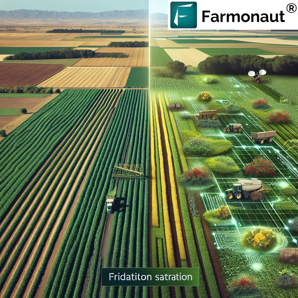
2. Leverage NDVI Mapping for Staged Crop Monitoring and Targeted Intervention
NDVI mapping across various growth stages reveals spatial differences and zones of stress that require attention. By identifying inconsistencies—areas affected by drought, pests, or disease—farmers and environmental managers can target interventions with surgical precision, resulting in higher efficiency and lower input costs.
- 🛰 Satellite imagery provides a bird’s-eye view for large farms or forests.
- 🚁 Drone-based NDVI delivers ultra-fine resolution for small, critical zones.
- 🛠 Integration with geofenced alerts triggers immediate field visits to vulnerable patches.
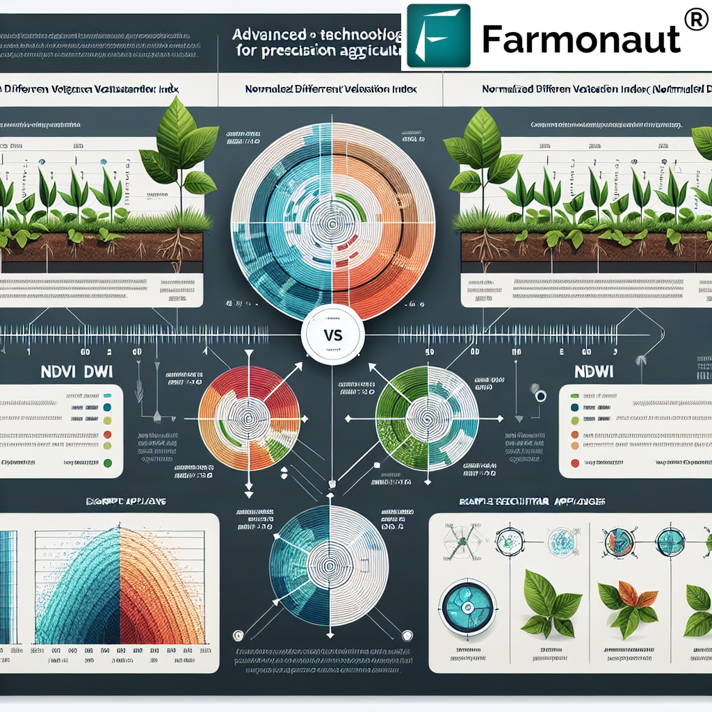
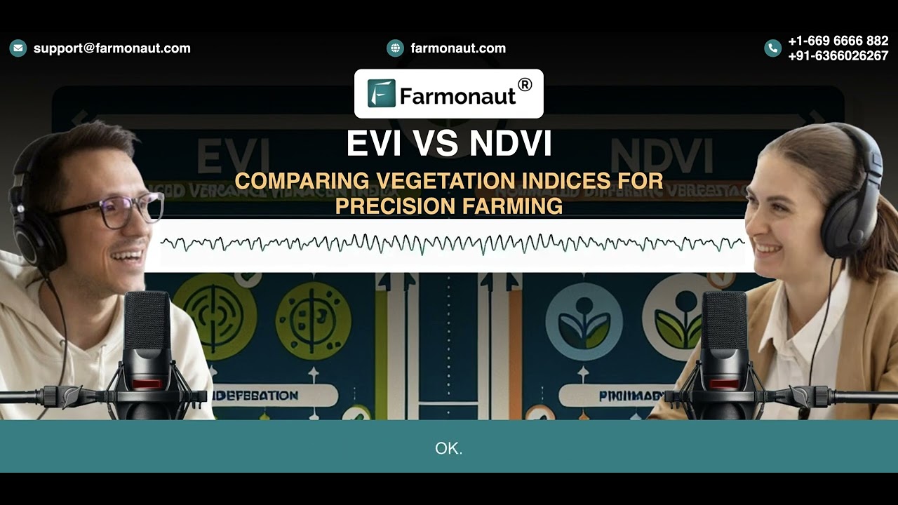
Pro Tip: Overlay NDVI maps on other indices (e.g., EVI, SAVI, NDWI) for enhanced accuracy under dense canopy or arid conditions.

-
3. Use NDVI Time-Series Analysis to Detect Early Stress and Predict Risks
Monitor NDVI patterns over time to uncover trends, diagnose recurring issues, and forecast risk before it becomes critical. This is invaluable for:
- ⚠️ Early detection of disease, drought, or pest episodes in crops and forests
- 📈 Visualizing ecosystem responses to climate change
- 🪓 Assessing forest regeneration or identifying subtle signs preceding deforestation or degradation
- 📆 Tracking recovery in rehabilitated mining or infrastructure-affected zones
-
4. Maximize Efficiency in Resource Application with Zone-Specific NDVI Insights
NDVI-guided variable rate applications are redefining how water, fertilizers, and pesticides are used in 2026. Instead of applying resources uniformly, data-driven delivery targets only those zones in genuine need—cutting input costs, increasing crop output, and reducing environmental impact.
- ✔ Saves up to 30% on total input costs (water, chemicals, labor)
- ✔ Improves yield potential and farm sustainability
- ✔ Reduces runoff, chemical drift, and ecological footprint
-
5. Harness NDVI for Forest Management & Early Deforestation Alerting
Forestry professionals utilize NDVI for real-time forest cover monitoring, detecting early signs of degradation, and tracking reforestation outcomes. In the context of climate change and resource pressures, NDVI is the cornerstone for sustainable forest management, accurate carbon footprinting, and biodiversity assessment.
- 🌳 Detect deforestation before it’s seen on the ground
- 🌲 Monitor recovery in replanted or rehabilitated forests
- 🦠 Anticipate pest or disease outbreaks and deploy interventions earlier
- 🌿 Quantify forest loss or regrowth with up to 98% accuracy
Learn about Farmonaut’s carbon footprinting product for forestry and agriculture: Track, audit, and optimize your environmental impact at scale with satellite data.
-
6. Apply NDVI to Mining, Infrastructure, and Beyond for Environmental Compliance
The utility of NDVI extends far beyond agriculture and forestry. For mining operations and major infrastructure projects, NDVI provides clear, auditable evidence of vegetation recovery and environmental compliance. Companies monitor reclamation efforts to ensure land returns to a healthy, vegetated state post-operation and guide adaptive management.
- 🧑💼 Supports regulatory reporting and corporate responsibility efforts
- ⛏ Tracks ecological restoration of formerly mined or disturbed lands
- 🚧 Guides impact reduction for infrastructure (roads, pipelines, energy projects)
- 🌱 Facilitates strategic replanting and erosion prevention programs
Explore Farmonaut Fleet Management for satellite-enabled tracking of land, machinery, and reclamation asset health, maximizing compliance and efficiency across your projects.
With the surge in regulations and ESG frameworks, NDVI-powered monitoring is now a compliance requirement for leading mining, infrastructure, and agricultural organizations in 2026.
-
7. Democratize NDVI Access: APIs, Apps & Cloud Platforms
The availability of near-real-time NDVI data from satellite constellations (like Sentinel-2) and cloud-based analysis (such as Google Earth Engine) means NDVI tools are no longer reserved for large enterprises. Anyone—smallholder farmers, co-ops, foresters—can access advanced vegetation insights affordably, from anywhere in the world.
- 📱 NDVI apps deliver updates on your mobile device or browser
- 🌐 APIs integrate NDVI analytics into business workflows and dashboards
- ☁ Cloud-based solutions scale to millions of hectares — no local hardware needed
Discover Farmonaut’s Blockchain Traceability Solution for agriculture, mining, and forestry. NDVI-backed traceability secures every stage of your supply chain with transparent, data-driven verification.

Comparative Benefits & Applications Table for NDVI in 2026
To help you visualize NDVI’s wide-ranging impact in 2026, here’s a comparative table illustrating how NDVI, remote sensing, and AI technology deliver measurable benefits across agriculture and forestry:
| Application Area | Key Benefits of NDVI | Example Technology Used | Potential Future Trends |
|---|---|---|---|
| Crop Health Monitoring | Increase yield up to 18% Early disease detection (95%+) |
Satellite & Drone Imagery, AI Analysis | Daily updates; deep learning diagnostics |
| Yield Prediction | Precise output estimates; 92% forecast confidence | NDVI Time-Series, Predictive Analytics | Integration with farm finance/insurance platforms |
| Deforestation Detection | Forest loss detection within 10 days; 98% accuracy | Satellite Monitoring, Change Detection Algorithms | Near real-time, AI-powered alerts |
| Sustainable Land Management | Zone-specific resource allocation; cost savings of 20-30% | IoT Sensors, NDVI Mapping | Automated variable-rate interventions |
| Environmental & Mining Reclamation | Revegetation status tracking; compliance assurance | Multispectral Satellite Data, Cloud AI | Blockchain traceability of reclamation actions |
| Pest and Disease Outbreak Management | Detect early stress patterns; minimize losses | AI-augmented NDVI Alerts, Time-Series Analysis | Weekly or real-time cloud updates; edge analytics |
| Large Scale Farm & Forest Administration | Centralized oversight; scalable to millions of hectares | Cloud NDVI Dashboards, Multimodal Data Fusion | Integrated with government/enterprise admin platforms |
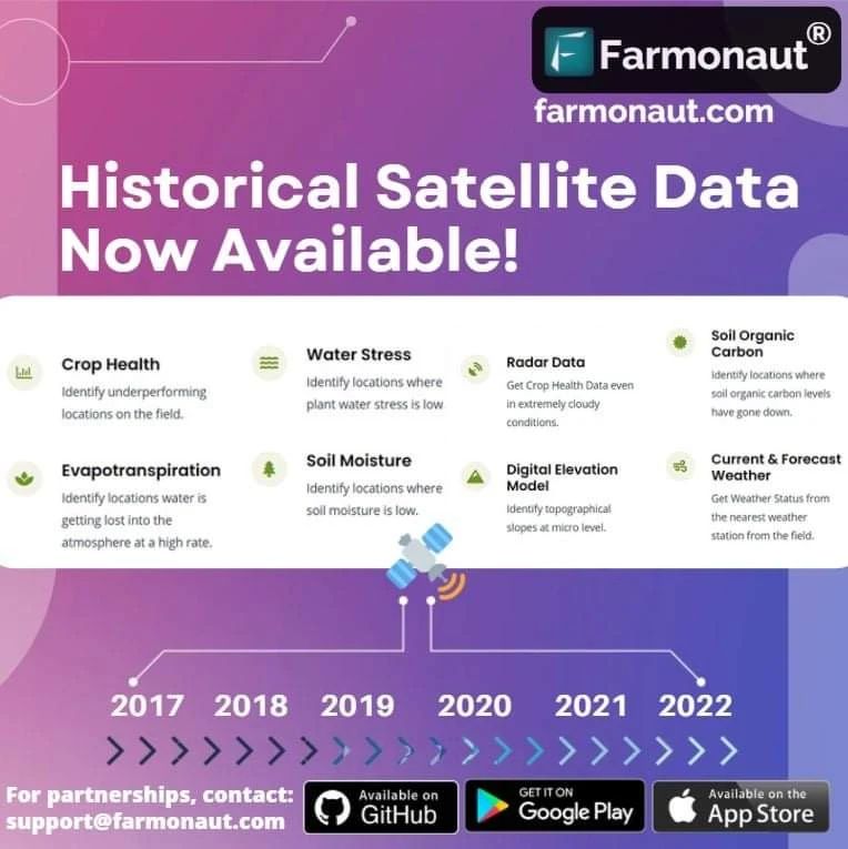
How Farmonaut is Enabling Data-Driven Decisions with NDVI & Remote Sensing
At Farmonaut, we harness the normalized difference vegetation index NDVI as a core pillar of our satellite-driven analytics platform. Our technologies are purpose-built for the agriculture, forestry, mining, and infrastructure sectors, providing cost-effective, scalable, and data-driven solutions for sustainableland management:
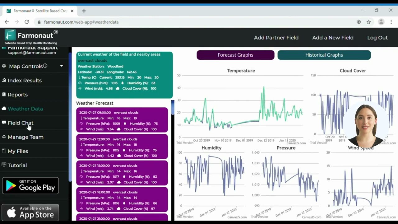
- 🌐 Multispectral Satellite Monitoring: We deliver real-time NDVI imagery to users worldwide, supporting informed agricultural and forestry decisions.
- 🧠 AI-Based Advisory: Our Jeevn AI system integrates NDVI and environmental indices to deliver actionable insights on crop health, irrigation scheduling, and field interventions.
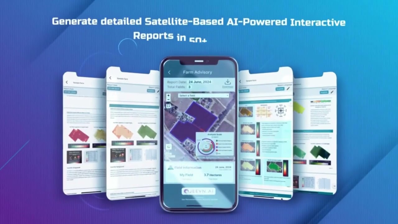
- 📲 NDVI Apps, APIs & Cloud Tools: Users access NDVI analytics on Android, iOS, web, or via secure API.
Try our satellite monitoring web app:

- 🛡 Blockchain Traceability: Ensures authenticity across supply chain, using NDVI and geospatial data as evidence.
Learn more about our product traceability solutions. - 🚜 Fleet & Resource Management: Satellite-enabled fleet tracking maximizes operational ROI across regions —
optimize your asset management here. - ♻ Environmental Impact: Track your carbon footprint, vegetation cover change, and resource use with our
carbon footprinting product. - 🔗 APIs for Integration: Advanced developers can integrate NDVI data directly into their models or dashboards—see our API here.
Full API docs at Farmonaut API Docs.
Mobile access: Download our mobile apps:


Farmonaut Platform: What Sets Us Apart:
- ✔ Global, multi-crop, and forest coverage
- 📊 Actionable analytics and AI-powered alerts
- 🌱 Cost-effective and scalable for any size operation
- 🕒 Real-time, API-driven connectivity
- 📕 User-friendly interface, mobile-responsive, and secure
Advanced Insights: The Future of NDVI, Remote Sensing & AI in 2026
The future of land management lies in the integration of NDVI with complementary indices, high-resolution satellite constellations, and rapidly evolving machine learning platforms. The next waves of innovation will include:
- 🤖 Deep learning-enhanced NDVI interpretation: Uncovering hidden patterns, forecasting stress with multi-factor analytics
- 🌐 API-first approaches: Seamless integration of NDVI, EVI, SAVI with farm/forestry management software
- 🛰 Ultra-high-frequency satellite updates: Near-hourly scans for urgent climate, pest, or environmental risks
- 💻 Advanced dashboarding: Integrating NDVI, fleet, traceability, and carbon tracking in a single, mobile-responsive interface
- 🔬 Spatially aware algorithms: Differentiating between crop/forest species and localizing interventions to a sub-hectare level
Visualization Tip: Use time-lapse NDVI overlays to instantly communicate field/forest health trends to stakeholders or regulatory authorities.
NDVI in Sustainable Land Management & Conservation (2026+)
The normalized difference vegetation index NDVI is not merely a passive indicator—it is now a cornerstone for sustainable planning and environmental stewardship:
- 🌳 Foresters monitor and maintain biodiversity, reforestation, and carbon sequestration with pinpoint confidence.
- 🌾 Farm managers maximize output while reducing chemical runoff, preserving soil, and responding to climate shocks.
- 🔎 Mining and infrastructure administrators guide post-operational recovery, demonstrating compliance and restoring ecosystem dynamics.
- 🏢 Government regulators enforce sustainable land management policies with data transparency and impartial evidence.
Did you know? NDVI is now a standard requirement for crop insurance verification/loans, improving access to finance and risk management.
NDVI Advantages for Environmental Management:
- 📈 Continuously updated vegetation health metrics
- 🌡️ Detect and respond to climate-induced stress rapidly
- 🛡️ Facilitate conservation, replanting, and rehabilitation efforts
- 🌍 Strengthen ESG reporting with verifiable, auditable data
- 🚜 Enable scalable solutions for farms, forests, and infrastructure projects
Pure NDVI can be affected by dense canopies, bare soil, or atmospheric interference. Always consider integrating with EVI or SAVI for enhanced accuracy under challenging conditions.
Accessing NDVI Insights: Apps, APIs & Digital Tools
The best insights are only valuable if accessible. Farmonaut delivers NDVI analytics via:
- 📱 Android App: Download from Google Play
- 🍏 iOS App: Download from App Store
- 💻 Web App: Launch the web-based Farmonaut system
- 🔗 APIs & developer docs: Direct access for business, developers, or researchers via Farmonaut API and API developer docs.
Integrate NDVI intelligence into your enterprise or government agritech infrastructure at any scale.
Farmonaut’s modular platform allows you to scale data access and analytics from individual field plots to regional or national land resource administration, ensuring cost-effective flexibility as your operations expand.
Farmonaut Subscription Pricing
Frequently Asked Questions (FAQ): Normalized Difference Vegetation Index NDVI
-
What is the difference between NDVI and other vegetation indices like EVI or SAVI?
NDVI is sensitive to vegetation, but can saturate in dense canopies or struggle under bright soil. Enhanced Vegetation Index (EVI) and Soil-Adjusted Vegetation Index (SAVI) address these limitations, providing more accurate data in dense forests, arid zones, or highly reflective areas.
-
Can NDVI be used all year round?
Absolutely. NDVI is valuable throughout all phenological stages—from early growth to harvest in agriculture, or year-round forest management. Satellite revisit rates now allow near-daily monitoring, even during cloudy seasons with synthetic aperture radar data.
-
Is NDVI data expensive or hard to access?
No. Advanced platforms like Farmonaut have democratized NDVI, providing affordable subscriptions, mobile apps, and APIs suited for individual users, businesses, and government agencies.
-
Are NDVI-based decisions recognized by insurance and banks?
Yes. NDVI is a global standard for objective, auditable verification of crop health, risk, and drought. Banks and insurers increasingly use NDVI for faster, more accurate assessments.
See Farmonaut’s crop loan and insurance validation solution. -
How can API integration help our geospatial business?
APIs unlock seamless, real-time integration of NDVI analytics into your internal dashboards, GIS systems, and analytic tools, ensuring your teams have the latest, actionable data without manual processing. Explore Farmonaut’s developer API for robust, scalable solutions.
Final Thoughts: Optimizing Land Stewardship with NDVI in 2026+
The Normalized Difference Vegetation Index NDVI is no longer simply a scientific metric; it’s a pivotal, action-oriented asset for every land manager, farmer, forester, and ESG-driven enterprise. In 2026, with satellite-driven, AI-augmented, and API-accessible NDVI data, we stand at the threshold of a future where sustainability and productivity go hand-in-hand.
Whether you are a large agribusiness, a progressive government agency, or a tech-savvy forester, NDVI provides the tools you need to stay agile, compliant, and sustainable.
Ready to transform your land stewardship? Try Farmonaut’s NDVI-powered solutions today: