Crop Insurance: 7 Aerial Imagery Analysis Advances
“In 2025, AI-powered aerial imagery can assess crop insurance losses up to 50% faster than traditional methods.”
“Over 7 innovative aerial imagery techniques are now transforming precision risk management in crop insurance analysis.”
Table of Contents
- Crop Insurance in 2025: Revolutionizing Agricultural Risk Management
- The Rise of Aerial Imagery in Crop Insurance Analysis
- Comparative Benefits Table: Traditional vs. AI & Aerial Imagery Advances
- 7 Aerial Imagery Analysis Advances Transforming Crop Insurance
- Impacts for Insurers and Farmers
- Farmonaut: Expanding the Future of Crop Insurance
- Integration with Emerging Technologies
- Best Practices, Common Mistakes & Key Callouts
- FAQs
- Conclusion
- Subscribe to Advanced Satellite Solutions
Crop Insurance in 2025: Revolutionizing Agricultural Risk Management
Crop insurance in 2025 remains a critical tool for safeguarding farmers’ livelihoods against increasing uncertainties—a landscape perpetually triggered by climate change, pest outbreaks, and market volatility. The fusion of aerial imagery analysis and AI-driven models has revolutionized agricultural insurance, offering precision, efficiency, and transparent support for both insurers and farmers.
Modern crop insurance is shifting rapidly from manual field inspections and slow claim processing to advanced, data-driven, AI-powered risk assessment thanks to aerial imagery and remote sensing technology.
Traditionally, crop insurance involved manual field inspections, reporting by farmers, and historical data analysis to estimate losses and validate claims. While long considered effective for mitigating risk, these methods often suffered from delays, inaccuracies, and disputes over settlements. In contrast, by 2026, advancements in aerial imagery analysis insurance are delivering unprecedented speed, accuracy, and transparency for all stakeholders in the sector.
What’s Changing? Why 2026+ is a Milestone for Crop Insurance
- ✔ AI-powered assessment—less subjective, more precise (reduces claim disputes).
- 📊 Aerial imagery analysis insurance—real-time, high-res data across vast areas.
- ⚠ Automated models now estimate, validate, and process claims—slashing delays.
- 🌾 Advanced sensors detect drought, flood, pest, and disease stress factors instantly.
- 🔗 Integration with platforms (like Farmonaut) for holistic agricultural management and transparency.

The Rise of Aerial Imagery in Crop Insurance Analysis
The revolution in crop insurance is being powered by aerial imagery analysis insurance and AI-driven analytics. This seismic shift is primarily due to:
- ✔ Sophisticated drones, satellites, and UAVs equipped with multispectral & hyperspectral sensors
- 📊 AI and machine learning algorithms driving real-time risk analysis and claim validation
- 🚀 Effortless integration of satellite data for faster processing and pinpointed premium adjustments
High-resolution aerial imagery enables insurers to assess crop health, damage extent, and growth patterns across immense agricultural regions quickly. This reduces dependency on subjective field reports and accelerates policy underwriting and claim settlements.
Integrate AI-powered aerial imagery indices (NDVI, NDWI) for early detection of stress factors like drought, pest infestations, and disease. This can prevent losses and support dynamic insurance premiums.

Why Real-Time Aerial Data is a Game Changer
- ✔ Accurately detect damage caused by flood, drought, or pests by comparing before/after imagery
- 📊 Yield & vigor indices (like NDVI—Normalized Difference Vegetation Index) strongly correlate with potential payouts
- ⚠ Immediate visual evidence increases transparency and trust in insurance determinations
- 🔄 Enables dynamic, parametric insurance models, triggering payouts automatically (no lengthy claims process)
- 🌐 Regulators and governments use aggregated data to enhance disaster responses & resilience programs

Comparative Benefits Table: Traditional Crop Insurance vs. 7 AI & Aerial Imagery Advances
| Advance Name | Description | Estimated Impact | Farmer Benefit |
|---|---|---|---|
| Traditional Baseline | Manual field inspections, paper reports, historical data review | Claim validation: 20+ days; risk estimation accuracy: ~70% | Slow payouts, subject to dispute, limited transparency |
| 1. Real-Time Crop Health Monitoring | AI-processed satellite & drone imagery assess NDVI and crop vigor | Up to 40% faster claims; 30% increase in risk detection accuracy | Quick loss detection; minimized lost revenue periods |
| 2. Automated Damage Detection | Algorithms spot flood, drought, pest, & disease signatures pixel-wise | Reduction of claim processing time by 50%; false claims drop 25% | Instant, objective damage reports with visual evidence |
| 3. Parametric Insurance Modeling | Payouts triggered by pre-set indices (e.g., drought severity, NDVI drop) | Settlements in hours, not weeks | Lightning-fast relief after loss event |
| 4. Geo-targeted Underwriting | Premiums and terms dynamically based on high-res location risk | Discounted premiums for low-risk; risk-adjusted coverage | Fairer prices and targeted protection |
| 5. Historical Pattern Analysis via Satellite Archives | Years of archived imagery and data for predictive risk modeling | Yield forecasting improved by 30+% | Better portfolio planning and risk mitigation |
| 6. Continuous Real-Time Monitoring | Persistent surveillance flags risk factors before escalation | Reduction in catastrophic loss magnitude; up to 50% fewer late claims | Maximized prevention, proactive farm management |
| 7. Blockchain-based Data Traceability | Immutable image/data records ensure fair claims, prevent fraud | Near-zero claim disputes, seamless audit trails | Trustworthy settlements and increased financial access |
The market for aerial imagery analysis insurance and AI-driven crop insurance solutions is projected to double by 2030 as agri-fintech, geospatial, and insurance sectors converge around big data and sustainability.
7 Aerial Imagery Analysis Advances Transforming Crop Insurance
As of 2026 and beyond, these 7 advances in aerial imagery analysis insurance are reshaping crop insurance for insurers and farmers globally:
-
1. Real-Time Crop Health Monitoring (NDVI & Indices)
With satellite and drone-based NDVI imagery (Normalized Difference Vegetation Index), insurers can evaluate crop vigor and potential yield almost instantly. Real-time vegetation index data is processed by advanced AI and machine learning algorithms to map stress factors, allowing claims to be assessed fast and objectively, reducing reliance on field adjusters and subjective reports.
- ✔ Pinpoints drought, pest, disease stress before catastrophic damage
- 📊 Enables immediate response to triggers for insurance coverage
- 🌱 Supports sustainable crop management
-
2. Automated Damage Detection (Flood, Drought, Pest, & Disease)
Hyperspectral and multispectral sensors on drones and satellites can detect subtle changes in crop patterns due to drought impact, flooding, pest infestations, and disease outbreaks. AI instantly classifies and quantifies damage, ensuring accurate estimates and reducing fraud risk.
- ⚠ Reduces processing times by up to 50%
- ✔ Lessens farmers’ financial stress by expediting payouts
-
3. Parametric Insurance & Automated Payouts
Parametric models leverage aerial imagery data (like a specified drop in NDVI or measurable drought) to trigger automatic payouts—eliminating the complexities of manual claims validation. Standards are set for images covering vast areas, and as soon as predetermined thresholds are breached, payment flows to the farmer.
- ✔ Payouts in hours vs. weeks or months
- 📊 Helps farmers recover faster after extreme weather events
-
4. Geo-Targeted Underwriting & Personalized Premiums
Using location-specific aerial imagery and historical data, insurers tailor premiums and policy terms dynamically. Satellite-based risk mapping allows for:
- 📍 Discounts for low-risk zones
- ⚡ Increased premiums for risk-prone plots
- 📊 Fairer, more granular coverage
Tip: If you’re a large-scale farm manager, consider leveraging
Farmonaut’s large-scale farm management platform. It harnesses continuous satellite monitoring for geo-targeted coverage optimization and cost control. -
5. Historical Pattern Analysis with Satellite Archives
Years of archived aerial imagery and weather data enable machine learning models to predict future risks—detecting recurring droughts, pests, and crop losses. This reduces underwriting uncertainty and supports better portfolio planning for insurers.
- 📈 Yield forecasting accuracy up by 30%+
- 🛡️ Improved resilience planning for both insurers and farmers
-
6. Continuous Monitoring, Early Alerts & Proactive Management
Persistent satellite surveillance reveals subtle changes—allowing for early alerts about environmental stress or pest outbreaks. This not only supports faster claim assessment but also allows farmers to implement timely solutions (like irrigation or pesticide application) to minimize losses.
- 📊 50% fewer late claims due to improved risk alerts
-
7. Blockchain-Backed Traceability & Secure Data
The integration of blockchain-based traceability solutions with aerial imagery ensures that data is immutable, claims are fairly audited, and fraud is nearly eliminated.
- 🔒 Dispute-free settlements and trust in every insurance outcome

“Over 7 innovative aerial imagery techniques are now transforming precision risk management in crop insurance analysis.”

Impacts of Aerial Imagery Analysis Insurance for Insurers & Farmers
For Insurers
- 📊 Precision risk assessment: Automated, AI-powered analysis for granular, up-to-date risk profiles across fields and agricultural regions
- ⚡ Underwriting refinement: Dynamic premiums and coverage tailored to actual crop risk in real-time
- 🔒 Improved fraud control: Immutable aerial imagery data reduces false or inflated claims
- ➕ Operational efficiency: Faster throughput; more policies underwritten; better portfolio management
- 📝 Regulatory reporting: Data for disaster relief, subsidy planning, and regional resilience strengthening
For Farmers
- 💸 Faster claim payouts for greater peace of mind in recovery periods
- 🔍 Visual evidence supporting insurance determinations, building trust and reducing disputes
- ⏳ Reduced time and hassle: Less paperwork and field visits
- 🛡️ Transparent, objective loss assessments—especially for remote or large farms
- 🌱 Continuous protection: Alerts for early risk intervention, not just after calamity


Many stakeholders still rely solely on manual inspections and field reports, missing out on the precision and speed of hybrid aerial + AI-powered analysis. Integrate both for best results!
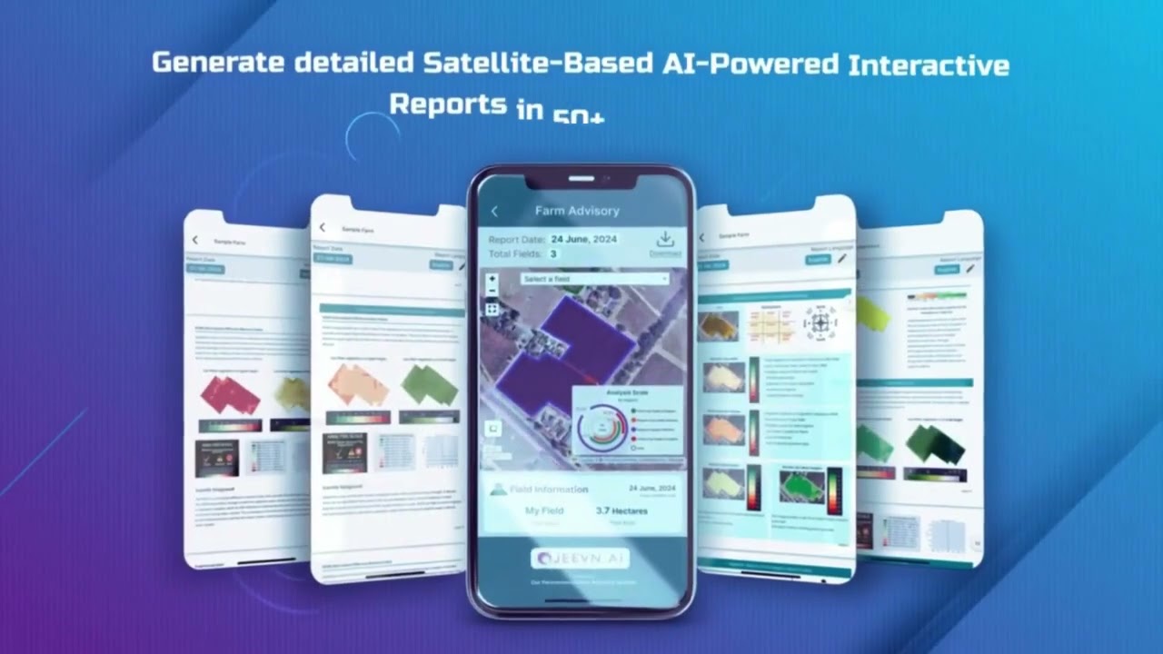
Farmonaut: Expanding the Future of Crop Insurance with Aerial Imagery Analysis Insurance
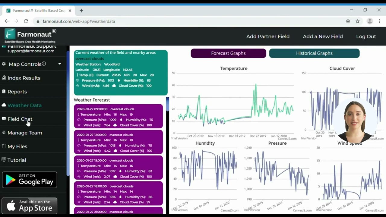
As a pioneering satellite technology company, Farmonaut is committed to making satellite-driven crop insurance solutions accessible and affordable for everyone. Our technologies blend multispectral satellite images, AI, blockchain, and real-time data to empower farmers, businesses, and insurers. Farmonaut offers:
- 🌐 Live crop monitoring via web, Android, and iOS for actionable risk management
- ⚡ Jeevn AI advisory system delivering customized insurance and farming strategies
- 🔗 Blockchain-powered traceability enhancing insurance transparency (see: traceability solutions)
- 📦 API & developer access for seamless integration—try our API and read the API developer docs
- 🌍 Environmental monitoring (like carbon footprinting) for insurers seeking green or sustainable portfolio compliance
- 🛡️ Agricultural and mining insurance verification, making loan processing, fraud detection, and settlements seamless
Top 5 Benefits of Satellite and AI-Powered Crop Insurance
- ✔ Faster Claim Settlements: Payouts in hours or days, not weeks
- 📊 Higher Risk Analysis Accuracy: 30%+ improvement vs. manual methods
- 🖼️ Visual Evidence for Transparency: Objective imagery eliminates disputes
- ⚡ Continuous Crop Health Alerts: Early warnings for preventive measures
- 🔒 Fraud Reduction: Blockchain-backed traceability secures every claim
Strategic Data Insights for Crop Insurance Using Aerial Imagery
- 🌦️ Weather impact mapping across fields for post-storm claim validation
- 🦗 Pest/disease outbreak zones identified by spectral changes for targeted intervention
- 🛰️ Yield forecast models using annual/decadal satellite archives
- 📍 Geo-zoned premium calculation based on risk cluster analysis
- 🔗 End-to-end digital claim workflows dissolving traditional paperwork bottlenecks
Beyond Imagery: The Future of Crop Insurance Integration
By 2026 and into the next decade, the future of crop insurance is a convergence of aerial imagery analysis insurance, AI, IoT sensors, weather forecasting models, and blockchain verification. Utilizing these technologies enables the next wave of dynamic insurance models:
- 💧 IoT soil moisture sensors for hyper-local drought trigger insurance
- 🌦️ Weather forecast AI for predictive premium adjustment
- 🔗 Blockchain records ensuring transparent, secure payouts
- 🛰️ Satellite time-series archives for continuous improvement and risk prediction
For farmers, this means: complete coverage from the start of the season, instant notifications of risk, and seamless financial recovery tools. For insurers, it means lower operational costs, less fraud, and a scalable way to serve millions of policies.
Best Practices, Common Pitfalls & Key Takeaways for Aerial Imagery Analysis Insurance
- ✔ Diversify Data Streams: Combine satellite, drone, and IoT sensor data for holistic risk analysis
- ⚠ Avoid Over-Reliance on Historical Data: Use real-time imagery to catch emerging risks, not just last year’s patterns
- 🖼️ Always Generate Visual Evidence: Insist on photographic/spectral proof for every settlement
- 📆 Schedule Regular Monitoring: Set up recurring satellite scans for prevention and timely claims
- 🔒 Implement Blockchain Traceability: Secure your insurance and loan records for all stakeholders
Frequently Asked Questions (FAQ)
-
What is aerial imagery analysis insurance?
Aerial imagery analysis insurance is a modern approach to crop insurance that uses drones, satellites, and advanced sensors to capture real-time data about crop health, stress, and damage, which is then analyzed using AI to facilitate rapid, objective risk assessment and claims processing.
-
How does AI improve crop insurance claim processing?
AI-powered algorithms analyze vast image datasets, automatically detecting and quantifying damages from drought, flood, pest, and disease. This reduces the time to estimate and validate claims, minimizes disputes, and provides transparency.
-
What sensors are used in aerial crop analysis?
The most common are multispectral and hyperspectral sensors, which capture data beyond standard visual (RGB) images. These sensors can highlight changes in plant health, water stress, pest infestation, and soil moisture.
-
What’s the main benefit for farmers?
Farmers benefit from faster payouts, greater transparency, and the ability to proactively manage risks (like drought or pest outbreaks) thanks to early warnings and objective evidence provided by aerial imagery integration.
-
Can I access these solutions on my mobile device?
Yes! Platforms such as Farmonaut offer mobile and web access, putting satellite-driven insights, AI advisories, and claim monitoring directly in your hands.
Conclusion: A New Era for Crop Insurance, Risk Management & Farmer Resilience
As climate change and market volatility upend agriculture, crop insurance will continue as a critical risk management tool—but only for those adapting to aerial imagery analysis insurance and AI-driven models. By leveraging real-time satellite data, advanced sensors, and automated machine learning, the agricultural insurance sector is revolutionized: delivering faster, fairer, and more transparent solutions for both farmers and insurers.
- ✔ Faster claim assessment, transparent payouts, and improved disaster response capabilities
- 📊 Higher accuracy in risk and loss prediction—building trust between farmers and insurers
- 🔗 Traceable, fraud-resistant systems thanks to blockchain-backed records
- ⚡ Sustainable farm management and compliance for a data-driven future
The integration of aerial imagery analysis insurance into crop insurance is fostering a smarter, more sustainable, and equitable agricultural landscape—securing both food production and farmer livelihoods well into 2026 and beyond.
Subscribe to Advanced Satellite Solutions for Agriculture, Mining & More
Access the future of crop insurance with innovative satellite and AI-powered platforms from Farmonaut.