Agricultural Geography: 2026 Innovation Trends
“By 2026, predictive analytics will influence up to 70% of crop planning decisions in precision agriculture worldwide.”
“Over 60% of new agricultural technologies in 2025 will utilize geospatial data to optimize land use sustainability.”
Table of Contents
- Introduction: Understanding Agricultural Geography in 2026
- Spatial Patterns and Emerging Technological Trends
- Natural Factors, Climate Change, and Crop Selection
- Land Use and Land Cover: Monitoring Change for Sustainability
- Water Resource Management: Spatial Intelligence for Efficiency
- Globalization, Trade, and Geospatial Disparities
- Urban & Peri-Urban Agriculture: Adapting to Spatial Realities
- Emerging Agri-Tech Innovations by Geographic Region (Estimated Impact by 2026) [Comparative Table]
- How Satellite Technology Empowers Agricultural Geography: The Farmonaut Perspective
- Technology Adoption in 2026: Precision Agriculture & Smart Solutions
- FAQ: Agricultural Geography and Innovation Trends for 2026
- Conclusion: Shaping the Future of Sustainable Agriculture
Introduction: Understanding Agricultural Geography in 2026
Agricultural geography remains a critical field of study in 2026, situated at the intersection of geography and agriculture. It examines the spatial patterns and processes that influence the dynamics of modern farming, shaping how land is used, how crops are chosen, and how sustainability is achieved.
This discipline helps farmers, policymakers, environmentalists, and economists in understanding the complex relationship between agricultural activities and the physical environment, socio-economic factors, and technological advancements.
In an era where climate change and food security have become pressing concerns, the use of spatial data and emerging technologies (including satellite monitoring, AI, and blockchain) are helping to reimagine and optimize farming systems globally. Agricultural geography provides the framework for analyzing these shifts and adapting to the dynamics of change.

What is Agricultural Geography?
- ✔ Examines spatial patterns in agricultural practices and their environmental, technological, social, and economic drivers.
- ✔ Analyzes land use, crop selection, and yield outcomes through a geographic lens.
- ✔ Interprets data on soil, climate, topography, and water to optimize sustainable farming.
📊 Key Elements of Agricultural Geography
- Geospatial Data
🗺️ - Remote Sensing
🛰️ - AI Analysis
🤖 - Resource Management
💧 - Sustainability
🌱
Spatial Patterns and Emerging Technological Trends
The analysis of spatial patterns in agriculture is central to understanding how farming activities are distributed across regions, what drives their variability, and how innovation may optimize these processes by 2026.
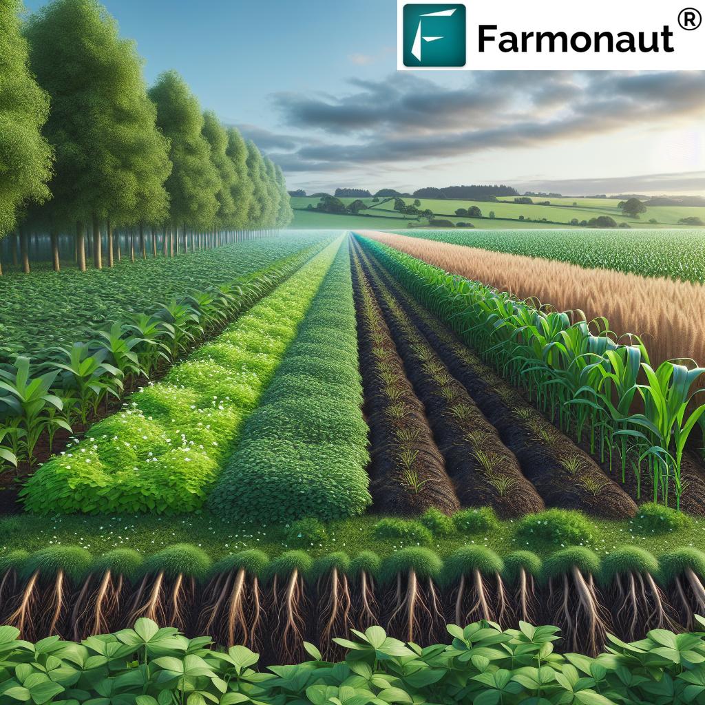
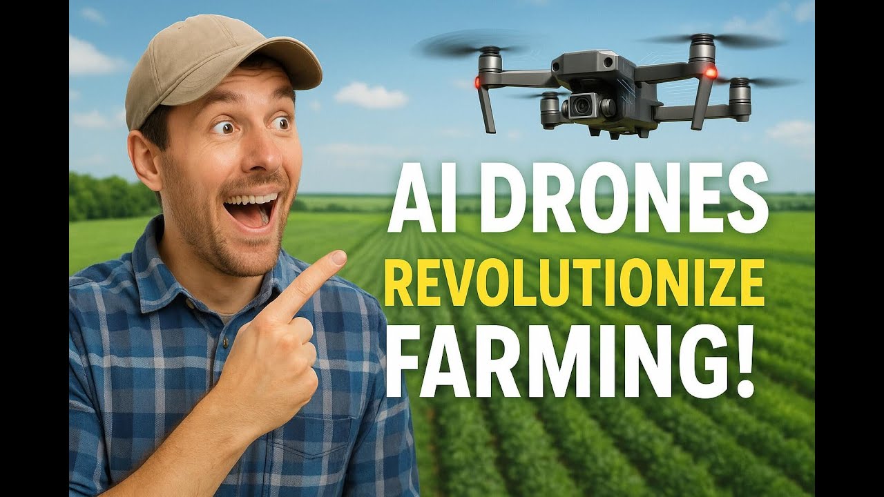
- Remote Sensing and GIS: Advanced GIS and remote sensing technologies have made it possible to monitor land cover, crop health, and soil degradation in real-time. This spatial data is critical for minimizing losses and optimizing resource allocation.
- AI & Predictive Analytics: Artificial intelligence helps in predicting crop yield outcomes and detecting emerging agro-climatic zones. By 2026, predictive analytics will drive most strategic decisions in crop planning (see trivia above).
- Precision Agriculture: By employing spatial analysis, farmers can variably apply water, nutrients, and pesticides – reducing input costs and environmental impact while improving yield.
As new technologies continue to evolve, agricultural geography is becoming increasingly dependent on high-resolution spatial data. Farmonaut, for example, leverages real-time satellite insights, AI advisories, and blockchain-based solutions that align with these trends (try Farmonaut’s app here).

Key Benefits of Modern Spatial Analysis in Agriculture:
- 🟩 Improved Yield Prediction using historic trends and climatic settings
- 🌏 Resource Optimization by matching crop types to geographic suitability
- 🛰️ Real-time Land Cover Monitoring to prevent deforestation or degradation
- 💡 Early Detection of disease or pest outbreaks by analyzing spatial clusters
- 🌱 Sustainability Assessment enabled by tracking land use and crop cycles over time
Natural Factors, Climate Change, and Crop Selection
Understanding the natural elements—such as soil types, climate variability, water availability, and topography—and how they affect crop selection remains foundational to agricultural geography.
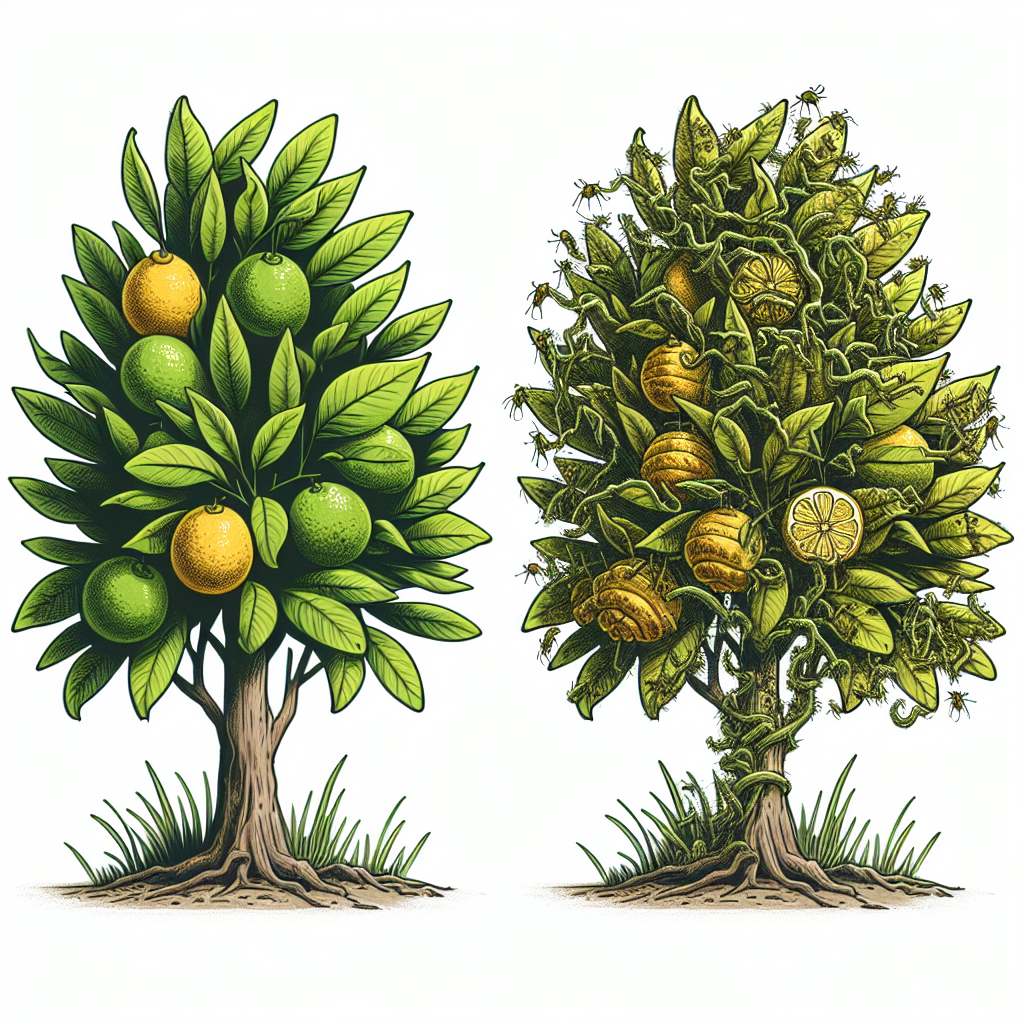
- 🌱 Soil: Soil texture, structure, depth, and fertility are crucial in determining which crops suit a region and what farming methods are most effective. AI-powered soil analysis (like Farmonaut’s NDVI tool) optimizes selection and fertilizer application.
- 🌦️ Climate: Shifting weather patterns due to climate change are making geographic studies pivotal for predicting new agro-climatic zones and adapting cropping systems accordingly.
- 💧 Water Availability: Precise mapping of water resources, coupled with remote sensing, underpins smarter irrigation practices and helps in planning drought-resilient systems.
- 🏞️ Topography: The slope and elevation of land affect both water run-off and the types of crops that can be grown. Digital elevation models generated from satellite imagery support tailored decisions.

Visual List: 📍 Natural Elements Impacting Agricultural Patterns
- Soil Quality
🟫 - Local Climate
☀️ - Water Access
💧 - Land Slope
🌄
For example, in Africa—specifically regions like Ethiopia and Malawi—the combination of increasing temperature variability and water scarcity is driving massive technological adoption (see trends table below and Africa-focused video links further down in the article).
Adapting cropping strategies to these shifting spatial realities is imperative. Digital platforms such as Farmonaut’s satellite-based crop health and weather advisory tools (explore Farmonaut’s app) are designed for this purpose, facilitating precision decisions at every stage of the planting and growing cycle.
Land Use and Land Cover: Monitoring Change for Sustainability
With global population growth escalating the demand for food, farming intensity is rising—sometimes driving unsustainable trends like deforestation, soil degradation, and water depletion. Agricultural geography equips us to observe, analyze, and manage these challenges using advanced, real-time spatial data tools.
- 🛰️ Remote Sensing: Monitors changes in vegetation, reveals patterns of degradation, and helps identify areas most at risk of unsustainable practices.
- 🌳 Geographic Information Systems (GIS): Enables spatial mapping of agricultural land, supporting sustainable management and policymaking.
- 🌲 Traceability & Sustainability: Blockchain-backed traceability (read about Farmonaut traceability solutions) ensures agricultural supply chains remain transparent and ecologically sound.
- 🌱 Resource Depletion Detection: Satellites can track water levels, soil moisture, and stress to guide optimal input use (explore carbon footprinting for sustainability).
Reducing Harm and Fostering Ecosystem Resilience
- 🌿 Prevent irreversible land and ecosystem harm by identifying degradation before it escalates.
- 🌎 Support policy for sustainable land conversion—guiding zoning, restoration, or conservation via evidence-based insights.
- 🔗 Verify supply chain authenticity through blockchain-based agricultural traceability.

Water Resource Management: Spatial Intelligence for Efficiency
Water is a pivotal factor in agriculture, especially in vulnerable regions where the availability and distribution of water resources directly influence yield and food security.
Geospatial management of irrigation systems is driven by data: Topographical analysis, satellite-derived soil moisture maps, and hydrological modeling enable precision irrigation.
- 💧Smart Irrigation: AI-powered scheduling based on weather, soil, and crop needs reduces waste while maximizing productivity.
- ⚠ Drought Management: Geographic studies help design drought-resilient cropping patterns, emergency water redistribution, and rainwater harvesting systems.
- 🛰️ Satellite Soil Analysis: Real-time data provides localized insights for each field optimized to micro-climates (use Farmonaut to monitor soil health).

African Geographies: A Case for Technological Intervention
- 🌍 Regions in Sub-Saharan Africa (e.g., Ethiopia, Malawi) face unique constraints, including low mechanization, market access issues, and rising water scarcity. Precision agriculture and mobile-based advisory platforms are increasingly bridging these gaps for 2026.
- 💦 Solar-Powered Pumps: Offer climate-smart irrigation in drought-prone African zones.
Globalization, Trade, and Geospatial Disparities
Globalization has radically altered agricultural patterns, exposing spatial disparities as commodity markets connect farms from Africa to North America and Asia-Pacific.
- 🌍 Trade Flows: Real-time spatial data reveals yield strengths, logistics bottlenecks, and emerging export opportunities.
- 🌐 Economic Geography: Patterns of prosperity or vulnerability—such as subsidized large-scale irrigated farms in the U.S. versus smallholders in Africa—may require region-specific interventions.
- 📈 Fleet management tools optimize movement of goods, resources, and machinery across both local and global agricultural supply chains.

Rural Economies and Spatial Inequality
- 📊 Smaller African farms: Digital platforms are enabling access to credit, agri-insurance, and advisory services—services previously limited to larger economies. Learn how satellite verification improves loan & insurance accessibility.
- 💼 Large North American & European farms: Adapting to stricter sustainability certifications and export competition; blockchain and AI are crucial for future market access.
Urban & Peri-Urban Agriculture: Adapting to Spatial Realities
With urbanization intensifying through 2026, urban agriculture and peri-urban farming are transforming city landscapes, integrating vertical farms, rooftop gardens, and local food systems into metropolitan areas.
- 🏢 Spatial Analysis: Geographic studies help identify suitable urban spaces, optimize placement of gardens, and target underserved communities for food production.
- 🌆 Environmental Impact: Reduces city food supply chain emissions, enhances local resilience, and increases community engagement with sustainable food systems.
- 📲 Satellite mapping: Monitors land use and tracks productivity from community gardens and rooftop farms.

Farmonaut’s large-scale farm management platform can be adapted for peri-urban and urban stakeholders, allowing communities and city planners to track urban farm productivity, resource use, and land cover over time.
Emerging Agri-Tech Innovations by Geographic Region (Estimated Impact by 2026)
| Region | Key Innovation | Estimated Adoption Rate | Projected Yield Improvement | Sustainability Impact | Example Use Case |
|---|---|---|---|---|---|
| North America | AI-powered Precision Agriculture, Autonomous Machinery | ~75% | +18% | High – reduced chemical/runoff, carbon monitoring | Automated variable-rate fertilizer application |
| Europe | Blockchain Traceability, Regenerative Practices | ~60% | +14% | Very High – supply chain transparency, biodiversity recovery | Farm-to-shelf food traceability with carbon labeling |
| Asia-Pacific | Remote Sensing, Mobile Advisories, Smallholder AI-Tools | ~68% | +13% | High – smallholder access, reduced input waste | Smartphone-based satellite crop health monitoring |
| Africa | AI-Driven Irrigation, Satellite Land Monitoring | ~50% | +20% | High – drought resilience, land recovery | Solar-pump irrigation in Mzimba, Ethiopia’s satellite yield planning |
| South America | Drone Use for Crop Monitoring, Environmental Impact Tracking | ~56% | +15% | Medium – supports deforestation reduction | Deforestation monitoring for soy/cattle farms |
Table: Impact of Agri-Tech in Agricultural Geography by Region, reflecting spatial patterns and future trends through 2026.

How Satellite Technology Empowers Agricultural Geography: The Farmonaut Perspective
As digital transformation accelerates in agriculture, the role of satellite technology continues to expand, unlocking unprecedented insights into geographic patterns, resource use, and sustainability in farming systems.
At Farmonaut, we leverage a suite of satellite-driven tools, AI-based advisory systems, and blockchain solutions for real-time monitoring, resource management, and supply chain transparency. Here’s how our technology supports the advancement of agricultural geography through 2026:
- 🛰️ Multispectral Satellite Monitoring: Delivers crop health, soil status, and land degradation updates to support decisions from planting to harvest.
- 🤖 Jeevn AI Advisory System: Analyzes satellite data to offer region-specific recommendations, weather forecasts, and risk assessment in real-time.
- ⛓️ Blockchain-Based Traceability: Brings authenticity and security to food and raw material supply chains, directly supporting sustainability and consumer trust.
- 🚜 Fleet & Resource Management: Optimizes logistics and usage of machinery, cutting costs and improving efficiency for both individual farmers and enterprises.
- 🌱 Carbon Footprint Tracking: Gives actionable data on emissions, aligns with global sustainability standards and helps farmers adopt greener practices. Read about Farmonaut’s carbon tracking benefits.
Explore Farmonaut’s API for integrating satellite weather & agricultural data into your own systems!
See Farmonaut API Developer Docs.
Our approach democratizes advanced spatial technologies for use in agriculture, mining, infrastructure, and defence via Android, iOS, web, and API—making sophisticated geographic insights accessible, affordable, and easy to implement.


Technology Adoption in 2026: Precision Agriculture & Smart Solutions
The coming era will be defined by the rapid adoption of digital tools, and their ability to integrate spatial data into every step of the agricultural value chain. Agri-innovation is thus not only about new hardware or seeds but about smarter use of data and understanding of spatial dynamics.
- 🚜 Automated Machinery: Reduces labor needs and supports farmers in regions with workforce shortages.
- 🛰️ Satellite-Based Advisory: Connects even the most remote rural areas to high-quality agronomic advice in real-time.
- 👨🌾 Democratized Access: Cloud-based and mobile solutions (like those offered by Farmonaut) make these innovations practical for both large enterprises and smallholder farmers.
In 2026 and beyond, precision agriculture adoption will further transform farming patterns and land use, aligning spatial resource management with both productivity and sustainability targets.
FAQ: Agricultural Geography and Innovation Trends for 2026
What is the role of spatial data in farming for 2026?
Spatial data, such as that gathered from satellites and GIS systems, provides critical insights into field variability, soil moisture, and crop health across diverse regions. This enables precise interventions that boost yields, conserve resources, and maintain ecosystem balance.
How does agricultural geography address sustainability?
By monitoring land use/cover change, tracing resource flows using blockchain, and promoting region-specific, data-driven management, agricultural geography helps prevent unsustainable exploitation and supports long-term food security.
Are satellite-driven solutions practical for smallholder farmers in Africa?
Yes. Mobile and API-based technologies democratize access, providing smallholders with actionable advice and real-time monitoring at affordable rates. This levels the playing field across disparate geographic and economic contexts.
What technologies are driving the biggest changes in agricultural geography?
Remote sensing, AI-driven predictive analytics, blockchain traceability, precision irrigation systems, and autonomous machinery are all reshaping how we interpret and manage agricultural landscapes.
How do Farmonaut’s tools contribute to regional agricultural development?
Our solutions equip users across regions—including smallholders in Africa, grain producers in North America, and mixed farms in Asia-Pacific—with data to optimize inputs, verify supply chains, and adopt sustainable practices efficiently.
Conclusion: Shaping the Future of Sustainable Agriculture
As we journey into 2026 and beyond, agricultural geography remains the foundation upon which sustainable, resilient, and productive farming systems are built. By integrating advanced technologies—satellite monitoring, AI, blockchain, and geospatial analytics—stakeholders can align land use, resource management, and food production with the true capabilities and limits of our natural environment.
This spatially informed approach is no longer optional—climate volatility, population growth, and market uncertainties require that every policymaker, agribusiness, and farmer harness data-driven decision-making for both yield and sustainability. Whether supporting rain-fed farms in sub-Saharan Africa or optimizing high-tech North American operations, geospatial intelligence is the universal key to addressing the critical challenges of agriculture in the next decade.
With platforms like Farmonaut, these insights are no longer reserved for the few. Our commitment is to make satellite-powered, AI-driven agricultural solutions available to all—empowering informed, equitable, and future-ready food systems worldwide.